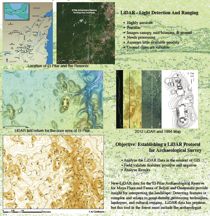
LiDAR: Cutting Edge Research Under Canopy
Using LiDAR, Light Detection And Ranging, exciting discoveries and cutting edge research are underway at El Pilar. A remote sensing technology, LiDAR images the forest canopy, plant biomass, and underlying topography by measuring light-pulse returns emitted from a laser as it passes over the landscape from a small aircraft.
This produces a massive “point cloud,” a dataset that can be managed, analyzed, and visualized using GIS, Geographic Information Systems. This produces extremely accurate maps of topography and features that the canopy masks from view.
The emergence and increasing use of LiDAR in Mesoamerican archaeology is driving a technological revolution in the field. The lush forests of Mesoamerica are difficult to traverse, making archaeological surveys extremely challenging. Referred to as the El Dorado Machine in the New Yorker, LiDAR maps massive swaths of land in days, a feat that used to take researchers years.
The use of LiDAR technology at El Pilar has revealed features and monuments never recorded before!
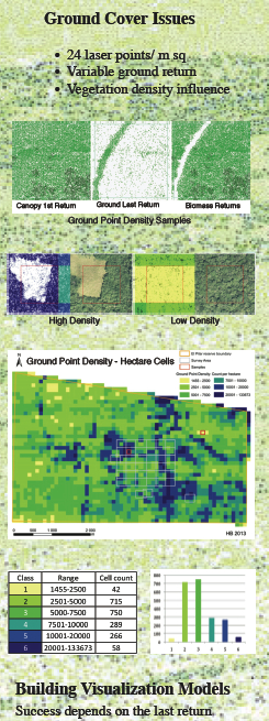 LiDAR Ground Cover
Building good models of the ground surface using LiDAR depends on the last return. =For forest areas, most of the laser point returns will be in the canopy and reflect the biomass above the ground. Our investigations of Maya sites is focused on the ground itself, and laser coverage of the ground surface is variable. Even when there are less than 1 laser return per square meter, we are finding that we can detect ancient architecture under the canopy.
 LiDAR Visualizations Must Be Reliable at Most Detailed Scale
Visualizations of the ground surface can be derived in many ways. We have experimented with over a dozen methods and have determined that the Thomas Pingle’s Simple Morphological Filter for the Terrain Classification of Airborne LIDAR Data gives us the best results.
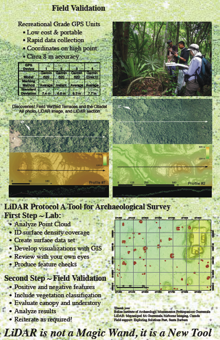 Field Validation
There is no magic wand with LiDAR! Field validation is essential. We are working on protocol and strategy to identify potential sites and make landscape determinations remotely. This can only work with field work that backs up the assessments. This is a work in progress!
We thank Mayaniquel of Guatemala for providing the LiDAR technology and imagery that make these new discoveries possible.